A historical map · Ayutthaya to Thonburi
In the footsteps ofKing Taksin
Tap a pin to read why that spot matters, choose a period to see what the place was like before the war, during the Burmese siege, at the fall and recapture of the city, in the Thonburi years and today, or tap Why does this spot matter? when you’re standing in Ayutthaya.
- 17places on the map
- 5periods to explore
- 11campaign routes
- 6chronicle episodes
- 15years of Thonburi
The Burmese armies besieged Ayutthaya for about 14 months. Phraya Tak fought in defence of the city, then broke out to the east on 3–4 January 1767
- Temple
- Palace
- Community
- Fort / camp
- Linked to King Taksin
- Not yet built in the selected period
- Burmese camp (shown by period)
- Where the enemy got in
- Your location
Coming up in Ayutthaya
- 12 Aug 2026 – 26 Dec 2026On nowKo Koet Arts of the Land of SiamKo Koet Arts and Crafts Centre, Bang Pa-in districtYear-end arts and crafts fairSource: Thairath — November 2026 travel calendar (in Thai) ↗
- 24 Nov 2026Loi Krathong Tam PrathipBang Sai Royal Arts and Crafts Centre, Bang Sai districtLoi Krathong day, 2026Source: Thairath — November 2026 travel calendar (in Thai) ↗
- 28 Dec 2026King Taksin the Great DayRoyal monuments across the country, such as Wongwian Yai in BangkokThe anniversary of his coronation on 28 December 1767. Government bodies hold ceremonies to pay homage (it is not a public holiday).
Latest event news (updated automatically)
Follow King Taksin's campaigns

From the breakout through the Burmese lines at Wat Phichai, the gathering of forces at Rayong and Chanthaburi and the return by sea to retake the capital at the Pho Sam Ton camp, to the wars that reunited the kingdom over the 15 years of Thonburi: this map traces 11 key campaigns, showing how the chronicles record each one and where historians still disagree.
- 1
- 2The capture of Chanthaburi: smashing the rice potsMay–June 1767
- 3The fleet that recovered the capital: Thonburi and the Pho Sam Ton campSeptember–November 1767
- 4
Burmese siege camps around Ayutthaya
The Burmese armies camped around the city for more than a year, from the main camps at Pak Nam Prasop and Pho Sam Ton in the north to the siege works at Hua Ro, where tunnels were dug under the city wall. On the map above, Burmese camps are the diamond-shaped pins: choose the siege period to see them all.
- 7Hua Ro siege worksSecond fall 1767
- 6Khok Phama moundsSecond fall 1767
- 8Phu Khao Thong campSecond fall 1767
- 14Pho Sam Ton campSecond fall 1767
Start with his life story
Main articleThe life of King Taksin the GreatFrom his birth in Ayutthaya and his years as Phraya Tak to the breakout through the Burmese lines, the recapture of the capital at Pho Sam Ton, the founding of Thonburi and the end of his reign, with the real places involved.Places linked to King Taksin
A star ★ marks places tied to King Taksin's life. Every page tells the place's story across all 5 periods.
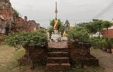 TempleWat Choeng Tha★The temple where the boy Sin is said to have studied under Phra Achan Thongdi, before he grew up to be Phraya Tak
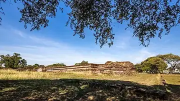 PalaceAncient Royal Palace★Where the young Sin was presented as a royal page, and where some chronicles say King Taksin spent the night after recovering the capital
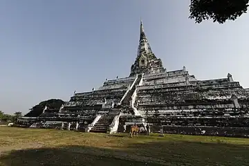 TempleWat Phu Khao Thong★The plain where Phraya Tak went out to fight the Burmese early in the war, and where the Burmese commander later set up his camp
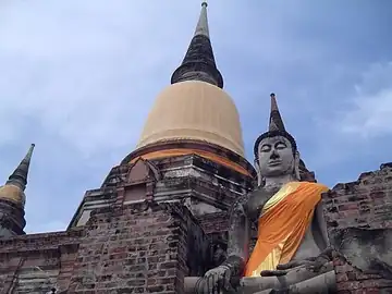 TempleWat Yai Chai Mongkhon★Where Phraya Tak and Phraya Phetchaburi stationed their flotilla during the floods at the end of 1766TempleWat Sangkhawat★The river battlefield where Phraya Phetchaburi was killed, in the fight that changed Phraya Tak's mind about defending the city
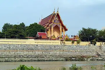 TempleWat Phichai Songkhram★Phraya Tak's last camp at Ayutthaya, and the starting point of his breakout through the Burmese siege on 3 January 1767CommunityBan Khao Mao★The line of march on the first night after the breakout, the night Phraya Tak saw the city on fireFort / campPho Sam Ton camp★The main Burmese camp north of the city, which King Taksin retook at the end of October 1767
From late Ayutthaya to Thonburi
Start with the overview, then read one period at a time: the Ban Phlu Luang dynasty, the war that ended Ayutthaya, the rival factions after the fall, and the Thonburi kingdom.
What the chronicles say
The chronicles tell the same events in different ways. We set them side by side, one event at a time, with links to the original texts.
Travel and food in King Taksin's footsteps
Other key places in the fall of Ayutthaya
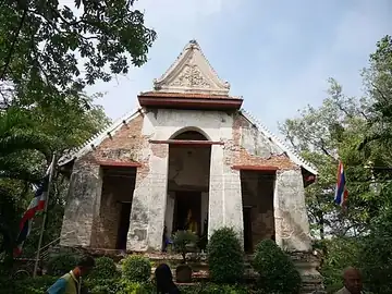 TempleWat Mae Nang PluemThe bank opposite Maha Chai Fortress where the Burmese camped to attack the city; what remains is Khok Phama, the "Burmese Mound", near the temple
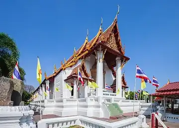 TempleWat Na Phra MenThe temple the Burmese used as a position for firing on the palace, which is why it escaped the fire on the night the city fell
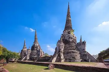 TempleWat Phra Si SanphetThe palace temple whose gold-covered Phra Si Sanphet image was burned and stripped of its gold on the night the city fell
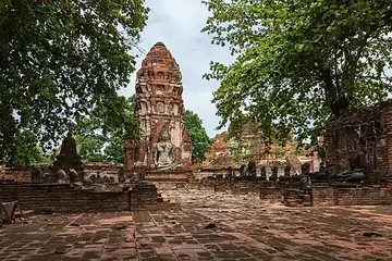 TempleWat MahathatThe great temple at the centre of the city island that was burned, its Buddha images beheaded, when the city fell
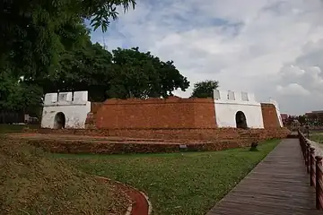 Fort / campPhet FortressThe river-mouth fort at the south-east corner, on the side where the Chinese volunteers' junks were trapped by a Burmese iron chain
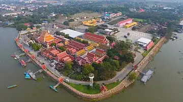 TempleWat Phanan ChoengThe temple of the riverside Chinese community, near the camp of the Chinese volunteers at Khlong Suan Phlu in the war of the fall
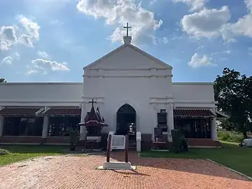 CommunityPortuguese SettlementThe Portuguese community whose camp fell in March 1767; some of its soldiers went on to serve in King Taksin's army
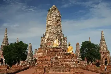 TempleWat ChaiwatthanaramThe riverside temple on the west bank that served as a stronghold on the southern side, holding out against the Burmese for nine days before it fell
King Taksin's life on the Ayutthaya map
Tap an event to jump to that spot on the map. Years are CE, with the Buddhist Era (BE) year used in Thai books shown beneath. Old documents that began the year in the fifth lunar month record the events of January–March 1767 (BE 2310) under BE 2309.
- 1734BE 2277
Born in Ayutthaya (17 April 1734 is the date generally accepted). There is no evidence of where in the city his family home stood.
Birthplace unknown - c. 1741BE c. 2284
Begins his schooling under the monk Phra Achan Thongdi at Wat Kosawat, today's Wat Choeng Tha.
View Wat Choeng Tha on the map - c. 1750sBE c. 2290s
Presented as a royal page at the Royal Palace, then sent to serve at Tak, where he rose to be its governor, Phraya Tak.
View Ancient Royal Palace on the map - 1766BE 2309
Late in January Phraya Tak and Phraya Phetchaburi go out to fight the Burmese on the plain by Wat Phu Khao Thong, but are beaten back.
View Wat Phu Khao Thong on the map - 1766BE 2309
During the November floods Phraya Tak and Phraya Phetchaburi command a flotilla stationed at Wat Yai Chai Mongkhon.
View Wat Yai Chai Mongkhon on the map - 1766BE 2309
The fight at Wat Sangkhawat: Phraya Phetchaburi's boats are surrounded and he is killed. The chronicles say Phraya Tak's force did not go to his aid.
View Wat Sangkhawat on the map - 1766BE 2309
Phraya Tak moves his camp to Wat Phichai, on the east bank of the Pa Sak River.
View Wat Phichai Songkhram on the map - 1767BE 2310
3–4 January: he breaks out through the Burmese lines from Wat Phichai, heading east. On the evening of the 4th, at Ban Khao Mao, the fire in the city can be seen.
View Ban Khao Mao on the map - 1767BE 2310
7 April: the Burmese set fires beneath the city wall at Maha Chai Fortress, Hua Ro, until the wall collapses. Ayutthaya falls.
View Maha Chai Fortress, Hua Ro on the map - 1767BE 2310
25–27 October: King Taksin attacks the Pho Sam Ton camp, held by Suki, and takes it.
View Pho Sam Ton camp on the map - 1767BE 2310
Late October: he has the body of King Ekkathat exhumed and cremated, and surveys the burnt-out city.
View Ancient Royal Palace on the map - 1767BE 2310
6 November: he leaves the Pho Sam Ton camp and goes down to set up his capital at Thonburi.
Thonburi (off this map) - 1767BE 2310
28 December: he is crowned king at Thonburi, which is why this date is King Taksin the Great Day.
Thonburi (off this map)
How this map works
This site pins 17 key places from King Taksin's life and the fall of Ayutthaya in 1767 at their real coordinates around the old capital, then tells the story of each one across 5 periods: the last years of Ayutthaya, the siege, the fall and recapture, the Thonburi years, and today. Places that did not yet exist in the period you choose appear as dashed pins. The Pho Sam Ton camp and Ban Khao Mao lie outside the map's opening view: zoom out, or tap their names in the list, to see them.
When you visit Ayutthaya, tap the “Why does this spot matter?” button. It uses your phone’s location to find the nearest important site and tells you how far away it is. Your location is used only on your device and is never sent or stored anywhere.