Home › Campaign routes › The breakout through the Burmese siege: from Wat Phichai to Rayong
The breakout through the Burmese siege: from Wat Phichai to Rayong
On the evening of Saturday 3 January 1767, Phraya Tak led some 500–1,000 Siamese and Chinese soldiers out through the Burmese siege lines from Wat Phichai, on the east side of Ayutthaya. They marched east for about three weeks, fought the pursuing Burmese four times, and passed through Nakhon Nayok, Prachin Buri and the Chonburi coast to reach Rayong at the end of January, which became the first base for the recovery of the kingdom. This page divides the route into 15 stops: tap a number on the map to read about each one.
- 1Stops, numbered as in the list below
- 2Clash with the Burmese
- 3Fighting with other forces
- 1–3Several stops close together: tap to zoom in
- ≈ approximate position
Press + to zoom in, then drag to move the map; on a phone you can pinch. Tap a number to read about that stop.
The ≈ sign marks an approximate location. Borders on the map are modern and shown for orientation only. Campaign routes are approximate lines drawn from the chronicles and modern studies, not the exact path taken. Dashed lines are enemy armies.
The first four days: the plains east of the city
The force left Wat Phichai at dusk on Saturday 3 January and soon had to fight the pursuing Burmese for the first time. The Royal Autograph version of the chronicle names the place in an older spelling of what is now the Hantra plain. The force then marched all night by way of Ban Khao Mao, reached Ban Sam Bandit after midnight, and from there saw the glow of the fire in the city.
The next day, Sunday 4 January, the force beat the Burmese twice more: first at Ban Pho Sao Han, then at Ban Phran Nok, where Phraya Tak rode out to fight with four other horsemen and broke a Burmese cavalry force of 30 horses. That is why 4 January is Cavalry Day. On Monday Khun Chamnan Phraison and an officer of the elephant corps came over with their elephants and offered to act as guides. On Tuesday 6 January the force stormed the stockade at Ban Bang Dong, which had refused to submit, and took elephants, money and gold, and a large stock of provisions. It was the first community, other than the Burmese, against which Phraya Tak had to use force.
Through Nakhon Nayok and Prachin Buri to the coast
From Ban Bang Dong the force followed the road to Nakhon Nayok, camped at Nong Mai Sum, and reached Ban Na Roeng around 9 January. One more day brought it to Prachin Buri, where it crossed eastwards at the Kop Chae checkpoint and then marched south along the edge of the Si Maha Phot forest. On Monday 12 January the Burmese stationed at Pak Nam Cho Lo, both their land force and their fleet, came up in pursuit. Phraya Tak had guns set in ambush on both sides of the road, then led a hundred-odd soldiers out to lure the Burmese into the line of fire, three times over. The Burmese broke, and this was the last fight with them on the route.
After that the force marched south through Ban Thong Lang, Taphan Thong and Bang Pla Soi, that is, Chonburi. On Monday 19 January it reached Ban Na Kluea, where Nai Klam, who had gathered men to block the way, submitted and then guided the force on to Pattaya. From there it camped at Na Chom Thian, Thung Kai Tia and Sattahip, and then followed the coast towards Rayong.
Rayong, the first base for the recovery of the kingdom
At the end of January the acting governor of Rayong and his officials came out to meet the force at Nam Kao and presented a cartload of rice. The force entered the town by way of Tha Pradu and camped at Wat Lum. Two days later a group of the town's officials brought about 1,500 men to raid the camp in the early evening. Phraya Tak had the lights in the camp put out and waited in silence until the raiders had crossed the Wat Noen bridge and come close, then ordered a volley and counter-attacked until they broke. Phraya Tak thus gained Rayong as a base for gathering men and supplies, before moving on to Chanthaburi four months later.
The route in 15 stops
The dates on this page are converted from the lunar dates in the Royal Chronicle, Phan Chanthanumat (Choem) version, taking Saturday, the 4th day of the waxing moon of the 2nd lunar month, as 3 January 1767. Some chronologies put the dates one or two days later.
- 1
Wat Phichai Songkhram
Phraya Tak gathered about a thousand Siamese and Chinese soldiers at his camp at Wat Phichai. His officers were Phra Chiang Ngoen, Luang Phrom Sena, Luang Phichai Racha, Luang Ratcha Sena, Khun Aphai Phakdi and Muen Ratcha Saneha. The chronicle says rain fell as an omen of great victory, and the force left the temple at dusk, breaking through the Burmese to the east.
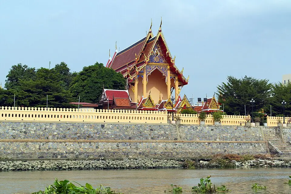
Wat Phichai Songkhram on the east bank of the Pa Sak River · Photo: Nord794ub · CC BY-SA 4.0 via Wikimedia Commons A temple on the east bank of the Pa Sak River in Kamang subdistrict, near Ayutthaya railway station, still home to a community of monks. In the Ayutthaya period it was called Wat Phichai; local people later added the word Songkhram (war) to the name, in memory of the fact that the recovery of the kingdom began at this temple.
Places to visit nearby
- Phet Fortress1.1 km
- Wat Phanan Choeng1.2 km
- Wat Yai Chai Mongkhon1.5 km
- Wat Mahathat1.6 km
- Ayutthaya travel guidesongkran.com
Where to eat nearby
- Roti Sai Mai Abeedeen-Pranom Sangaroon (โรตีสายไหม อาบีดีน-ประนอม แสงอรุณ) ↗near Phet FortressRoti sai mai (Thai cotton-candy roti), with a choice of 2 flavours of wrap
- Baan Pomphet (บ้านป้อมเพชร) ↗near Phet FortressGrilled river prawns and freshwater shellfish dishes
- Phae Krung Kao (แพกรุงเก่า) ↗near Wat Phanan ChoengCharcoal-grilled river prawns, green curry with clown knifefish balls
- Restaurants around this stop ↗Google Maps
- 2
Ban Hantra (the Hantra plain)
Not long after leaving Wat Phichai, the Burmese besieging the city caught up with the force. This was the first fight on the route.
Clash with the Burmese army- Against
- Burmese troops pursuing from the siege lines; the chronicles give no number
- Where
- The Hantra plain, north-east of Wat Phichai. Research places the battlefield across from Wat Hantra. The Royal Autograph version of the chronicle writes the village's name in an older spelling.
- How
- The chronicle says only that they "fought the Burmese hard", that is, with all their strength. It does not describe the tactics.
- Outcome
- The Burmese could not hold them and fell back. The force marched on at once, that same night.
A community and rice fields in Hantra subdistrict, Phra Nakhon Si Ayutthaya district, with Wat Hantra as the landmark. There is no memorial or sign marking the battlefield. You can stop here on the drive from Wat Phichai to Ban Khao Mao.
Position on the map: Approximate coordinates, around Wat Hantra in Hantra subdistrict
Places to visit nearby
- Wat Phichai Songkhram3.2 km
- Ban Khao Mao3.3 km
- Maha Chai Fortress, Hua Ro3.4 km
- Wat Yai Chai Mongkhon3.4 km
- Wat Hantra ↗Google Maps
- Wat Maheyong ↗Google MapsThe Burmese royal camp at the first fall of Ayutthaya, on the way
- Ayothaya Floating Market ↗Google MapsA place to stroll and eat, near Wat Maheyong
- Ayutthaya travel guidesongkran.com
Where to eat nearby
- Restaurants around this stop ↗Google Maps
- 3
Ban Khao Mao
The force marched by night along the road through Ban Khao Mao. Local legend says the villagers had food ready for them, and tells of a fight at Khlong Chana. Neither story is in the chronicles. The researchers think the villages in this area had probably been deserted by then.
The line of march on the first night after the breakout, the night Phraya Tak saw the city on fire
Position on the map: Coordinates of the centre of today's Ban Khao Mao
Places to visit nearby
- Ayutthaya travel guidesongkran.com
Where to eat nearby
- Restaurants around this stop ↗Google Maps
- 4
Ban Sam Bandit
They reached Ban Sam Bandit a little past the second watch, that is, shortly after midnight, and looking back saw the glow of fire in the capital. The chronicle says the fire burned from Tha Sai along the main road as far as Wat Chatthan. The force rested here until dawn.
Sam Bandit subdistrict is about 17 kilometres from the old city. The force covered that distance in a single night, from dusk until after midnight. Today it is a community among rice fields, with Wat Sam Bandit as the place to stop. Local legend says the force met three monks here; the research team of the Thammasat Journal of History considers this rather unlikely.
Position on the map: Approximate coordinates, around Wat Sam Bandit, Sam Bandit subdistrict, Uthai district
Places to visit nearby
- Wat Sam Bandit ↗Google Maps
- Ayutthaya travel guidesongkran.com
Where to eat nearby
- Restaurants around this stop ↗Google Maps
- 5
Ban Pho Sao Han
At dawn the force marched on to Ban Pho Sao Han, where the Burmese caught up with it a second time.
Clash with the Burmese army- Against
- Burmese troops pursuing from the capital
- Where
- Ban Pho Sao Han, Pho Sao Han subdistrict, Uthai district, about 5 km from Ban Sam Bandit
- How
- Phraya Tak had his Siamese and Chinese soldiers ready in advance; when the Burmese arrived he led his men out to fight.
- Outcome
- The Burmese broke and scattered. Phraya Tak's side collected a great many weapons.
It is Village 3 of Pho Sao Han subdistrict, about 5 kilometres from Ban Sam Bandit. Local legend explains the village's name by saying that a woman named Pho led the villagers out to help Phraya Tak's force and died in the fighting. This is the community's own tradition and is not in the royal chronicles. Today it is a farming community; you can stop at Wat Pho Sao Han before going on to Ban Phran Nok.
Position on the map: Coordinates of the centre of today's Ban Pho Sao Han, Uthai district
Places to visit nearby
- Wat Pho Sao Han ↗Google Maps
- Ban Phran Nok Memorial ↗Google MapsAbout 3 km away
- Ayutthaya travel guidesongkran.com
Where to eat nearby
- Restaurants around this stop ↗Google Maps
- 6
Ban Phran Nok
The force halted for the night at Ban Phran Nok. Soldiers who went out to find food ran into another Burmese force, which had come up from Bang Khang in the territory of Prachin Buri, and were chased back to the camp.
Clash with the Burmese army- Against
- The Burmese force from Bang Khang: 30 horsemen and 2,000 foot soldiers according to the royal chronicle; Prince Damrong Rajanubhab gives about 200 foot soldiers
- Where
- Ban Phran Nok, Village 2, Pho Sao Han subdistrict, Uthai district, about 3 km from Ban Pho Sao Han
- How
- Phraya Tak mounted and rode out first with 4 other horsemen. The rest of his soldiers formed two wings and attacked from both sides.
- Outcome
- The 30 Burmese horsemen were driven back into their own foot soldiers, and the whole force broke. 4 January has been Cavalry Day ever since.
It is Village 2 of Pho Sao Han subdistrict. The memorial stands in the grounds of Wat Phran Nok and Wat Ban Phran Nok School, with a statue of King Taksin the Great. The province holds a flower-laying and offering ceremony every 4 January; if you go on the day, set out early. Legend has it that the village is named after old Kham, a hunter (phran) who led soldiers out to look for food and came upon the Burmese force.
Position on the map: Approximate coordinates, about 3 km from Ban Pho Sao Han. The directions button searches Google Maps by the place name.
Places to visit nearby
- Ban Phran Nok Memorial (Wat Phran Nok) ↗Google Maps
- Wat Pho Sao Han ↗Google MapsThe previous battlefield, about 3 km away
- Ayutthaya travel guidesongkran.com
Where to eat nearby
- Restaurants around this stop ↗Google Maps
- 7
Ban Bang Dong (Ban Dong)
On Monday morning Khun Chamnan Phraison and an officer of the elephant corps came over to Phraya Tak, presenting 5 bull elephants and 1 cow elephant, and then guided the force to Ban Bang Dong. The headman there refused to join and had gathered armed men. Phraya Tak sent envoys three times to win him over, without success.
Fighting (not the Burmese)- Against
- More than 1,000 men of Ban Bang Dong: fellow Siamese, not Burmese troops
- Where
- The stockade at Ban Bang Dong. Its location is uncertain; one suggestion places it in the Bang Kong area, Wihan Daeng district, Saraburi province
- How
- On Tuesday Phraya Tak rode in at the head of 20 soldiers. The villagers fired on them from front and rear, but the soldiers climbed in and took the stockade.
- Outcome
- The villagers fled the stockade. The force took 7 elephants, money and gold, and a large stock of provisions.
The chronicles do not say where Ban Bang Dong was, only that it lay between Ban Phran Nok and the road to Nakhon Nayok. Sujit Wongthes suggests that the clash took place in the Bang Kong area of Wihan Daeng district, Saraburi province. The pin on the map is therefore an approximate position based on that suggestion.
Position on the map: Location uncertain; pinned according to the suggestion that it lay in the Bang Kong area, Wihan Daeng district, Saraburi province
- 8
Ban Na Roeng, Nakhon Nayok
On Wednesday the force moved on to camp at Nong Mai Sum, on the road to Nakhon Nayok, then marched two more days to Ban Na Roeng. There was no fighting on this stretch.
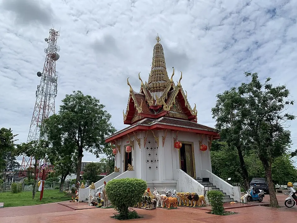
Nakhon Nayok City Pillar Shrine in today's town centre · Photo: Chainwit. · CC BY 4.0 via Wikimedia Commons The chronicles write the name in an older spelling and call the previous halt Nong Mai Sung. Neither place can yet be located exactly, so the pin on the map uses the town of Nakhon Nayok instead. Nakhon Nayok today is a nature destination close to Bangkok.
Position on the map: Exact location unknown; the town of Nakhon Nayok is used instead
Places to visit nearby
- Khun Dan Prakan Chon Dam ↗Google Maps
- Sarika Waterfall ↗Google Maps
- Nakhon Nayok City Pillar Shrine ↗Google Maps
Where to eat nearby
- Restaurants around this stop ↗Google Maps
- 9
Prachin Buri and the Kop Chae checkpoint
One day's march from Ban Na Roeng brought the force to Prachin Buri. It crossed at the Kop Chae checkpoint, stopped to cook on the east side, then marched across the plain until five in the afternoon.
The Burmese force that fought at Ban Phran Nok had also come up from this area, which the chronicles call Bang Khang. They say that at the Kop Chae checkpoint Phraya Tak found that three officers, Phra Chiang Ngoen, Khun Phiphit Wathi and Nak Ong Ram, had not kept up. He rode back with Luang Phrom Sena to look for them but did not find them. Two days later Phra Chiang Ngoen caught up and was punished with 30 strokes of the rattan.
Position on the map: Approximate position, around the town of Prachin Buri and the Kop Chae checkpoint
Places to visit nearby
- The Si Maha Phot bodhi tree, Wat Ton Pho Si Maha Phot ↗Google MapsAn ancient bodhi tree in the Si Maha Phot forest, along which the force marched south
- Chaophraya Abhaibhubejhr Building ↗Google Maps
- Prachin Buri National Museum ↗Google Maps
Where to eat nearby
- Restaurants around this stop ↗Google Maps
- 10
Pak Nam Cho Lo and the edge of the Si Maha Phot forest
The force went into the forest and rested at a pond. At four in the afternoon soldiers from the rearguard came running in, cut at by pursuing Burmese. Nai Bunmi rode back about 200 sen (about 8 km) to look, and found a Burmese force coming up from Pak Nam Cho Lo, by land and by water, which had landed at Tha Kham.
Clash with the Burmese army- Against
- The Burmese land force and fleet stationed at Pak Nam Cho Lo
- Where
- Beside the road among the reed thickets, between the edge of the Si Maha Phot forest and Pak Nam Cho Lo. The exact site is still debated: the memorial chedi is at Pak Nam Cho Lo, Bang Khla district, while Sujit Wongthes suggests the fight took place at Tha Kham, Phanom Sarakham district
- How
- Phraya Tak had large and small guns set in ambush on both sides of the road and sent the porters with the provisions on ahead. He then led a hundred-odd soldiers out to lure the Burmese, about 6–7 sen (about 250 metres) in front of the guns. When the pursuing Burmese came within range, the guns fired together. They lured and fired in this way three times.
- Outcome
- The Burmese fell in heaps and broke. The soldiers shouted and beat gongs and drums after them, so that the Burmese could not rally. After this fight the chronicles mention no further Burmese pursuit.
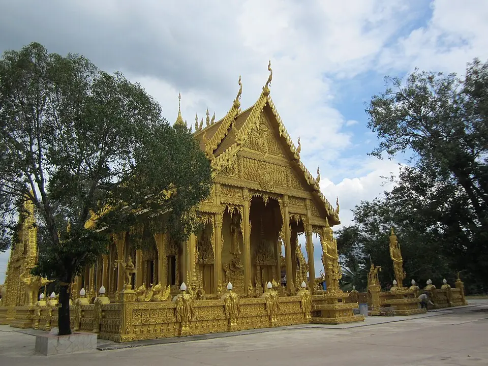
The golden ordination hall of Wat Pak Nam Jo Lo, Bang Khla district, Chachoengsao · Photo: Thaweesak Churasri · CC BY 3.0 via Wikimedia Commons The chronicles say the Burmese came up from Pak Nam Cho Lo, landed at Tha Kham and then fought beside the road among the reed thickets, so the fighting did not take place at the river mouth itself. Some versions of the chronicles write the name of the river mouth as Chao Lo. Sujit Wongthes suggests the site was at Tha Kham in Phanom Sarakham district, and Fine Arts Department evidence has been cited to show that the fighting did not happen where the chedi stands. At the river mouth there is a memorial chedi for the event. Next to it, Wat Pak Nam Cho Lo has an ordination hall that is gold all over, and a statue of King Taksin beside the hall, facing the river.
Position on the map: The pin is at Wat Pak Nam Cho Lo, Bang Khla district; the actual site of the fighting is still debated
Places to visit nearby
- Wat Pak Nam Cho Lo (the golden ordination hall) ↗Google Maps
- King Taksin the Great Memorial, Pak Nam Cho Lo ↗Google Maps
- Wat Pho Bang Khla ↗Google MapsA temple whose trees are full of roosting flying foxes
Where to eat nearby
- Bang Khla Floating Market ↗Google MapsFood beside the Bang Pakong River; open at weekends, so check before you go
- Restaurants around this stop ↗Google Maps
- 11
Bang Pla Soi (Chonburi)
The force marched south by stages, through Ban Thong Lang and Taphan Thong (Phan Thong) to Bang Pla Soi, that is, Chonburi. The chronicles record no events along this stretch.
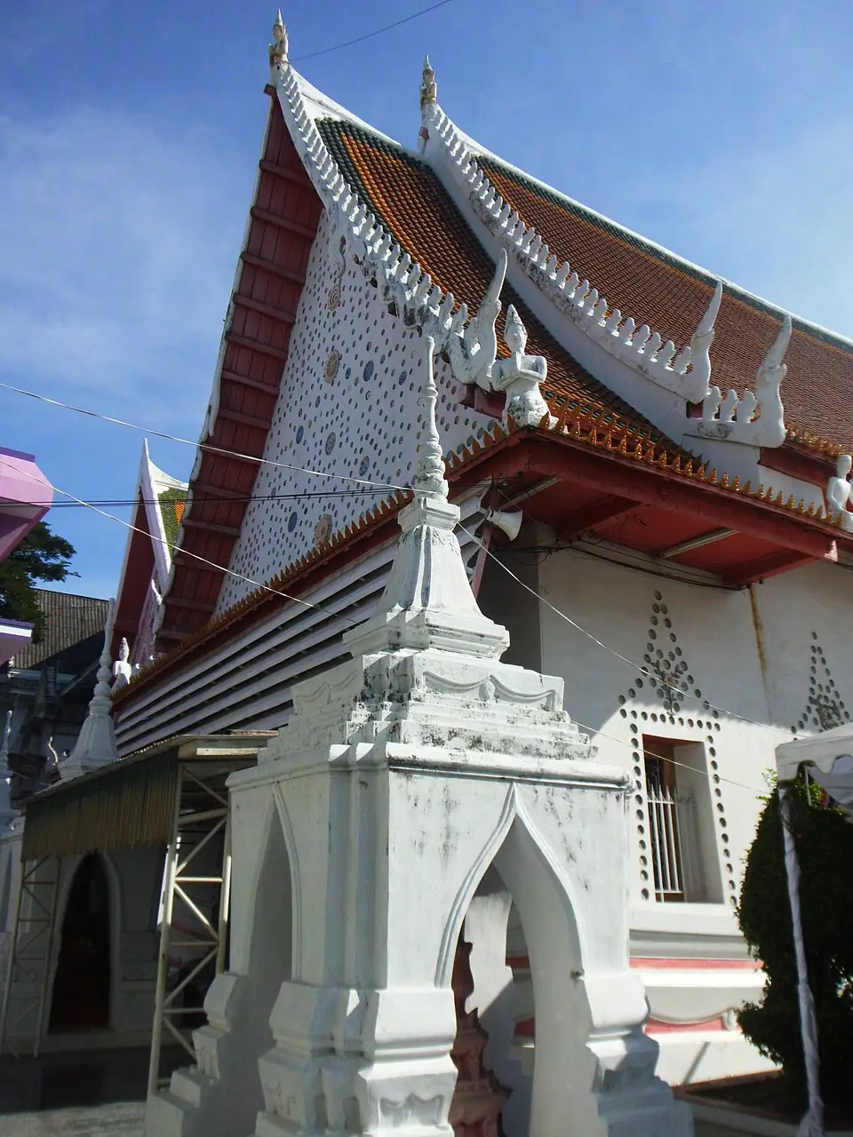
Wat Yai Intharam in the centre of Chonburi · Photo: กสิณธร ราชโอรส · CC BY-SA 4.0 via Wikimedia Commons The Taphan Thong of the chronicles is today's Phan Thong, and Bang Pla Soi is still the name of a subdistrict in the centre of Chonburi. The chronicles give no detail for this stretch, only the order of the places the force passed. At Wat Yai Intharam in the town centre, tradition says Phraya Tak once stopped to gather men, and the mondop there has murals on the recovery of independence.
Places to visit nearby
- Wat Yai Intharam ↗Google Maps
- Ang Sila Old Market ↗Google Maps
- Chonburi travel guidesongkran.com
Where to eat nearby
- Nong Mon Market ↗Google MapsKhao lam (sticky rice roasted in bamboo) and dried seafood to take home
- Restaurants around this stop ↗Google Maps
- 12
Ban Na Kluea
Nai Klam had gathered men to block the way at Ban Na Kluea. The royal chronicle says Phraya Tak, fully armed on his elephant and holding his royal gun, the red-stocked Rang Daeng, led his soldiers into the middle of Nai Klam's men. Nai Klam and his followers laid down their weapons and submitted; they were given gifts of money and told to keep to what was just. The next day Nai Klam and 100 of his men guided the force to Pattaya.
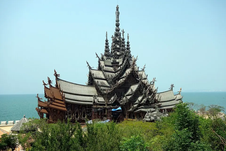
The Sanctuary of Truth on the Na Kluea shore, the area's best-known sight today · Photo: Rolf Heinrich, Köln · CC BY 3.0 via Wikimedia Commons Na Kluea today is an old fishing community north of Pattaya, with a seafood market and the Sanctuary of Truth on the shore.
Places to visit nearby
- Sanctuary of Truth ↗Google Maps
- Na Kluea Long Bridge ↗Google Maps
- Chonburi travel guidesongkran.com
Where to eat nearby
- Lan Pho Na Kluea Market ↗Google MapsFresh seafood, with shops beside the market that will cook it for you
- Restaurants around this stop ↗Google Maps
- 13
Pattaya and Na Chom Thian
Guided by Nai Klam and his 100 men, the force reached Pattaya and stayed one night. The next day it moved on to Na Chom Thian for another night.
Local legend says the name Pattaya comes from Thap Phraya, "the Phraya's army", as villagers called the place where the force camped on this march. This is the town's own story and is not in the chronicles.
Places to visit nearby
- Jomtien Beach ↗Google Maps
- Khao Phra Tamnak (Pattaya viewpoint) ↗Google Maps
- Chonburi travel guidesongkran.com
Where to eat nearby
- Restaurants around this stop ↗Google Maps
- 14
Thung Kai Tia and Sattahip
The force camped at Thung Kai Tia, and the next day at Sattahip. It then followed the coast for three more days, halting at Hin Khong and Nam Kao.
Position on the map: The exact location of Thung Kai Tia is unknown; the pin is in the Sattahip area
Places to visit nearby
- Nang Ram Beach ↗Google Maps
- Luang Pho I's hall, Wat Sattahip ↗Google Maps
- Chonburi travel guidesongkran.com
Where to eat nearby
- Restaurants around this stop ↗Google Maps
- 15
Rayong: Tha Pradu and Wat Lum
The acting governor of Rayong and his officials came out to meet the force at Nam Kao and presented a cartload of rice. The force entered the town by way of Tha Pradu and camped at Wat Lum for two days. During that time word came that a group of the town's officials were plotting to raid the camp, so Phraya Tak had the acting governor held and prepared to meet the attack.
Fighting (not the Burmese)- Against
- Rayong officials of the faction of Khun Ram Muen Song, Khun Cha Mueang Duang and Luang Phon Saen Han, about 1,500 men; not Burmese troops
- Where
- The camp at Wat Lum and the Wat Noen bridge, in the centre of Rayong
- How
- A little after seven in the evening the raiders crept up, took up positions on two sides of the camp, and came on shouting and firing. Phraya Tak had the lights put out and kept his men still until Khun Cha Mueang Duang and about 30 soldiers had crossed the Wat Noen bridge to within 5–6 wa (some 10–12 metres) of the camp. Then he ordered a volley and charged out to fight hand to hand, breaking into the raiders' lines.
- Outcome
- The raiders were routed, and the soldiers chased them for 50–60 sen (about 2–2.4 km). Phraya Tak now had Rayong as his first base, and rested and fed his men here before planning the move on Chanthaburi.
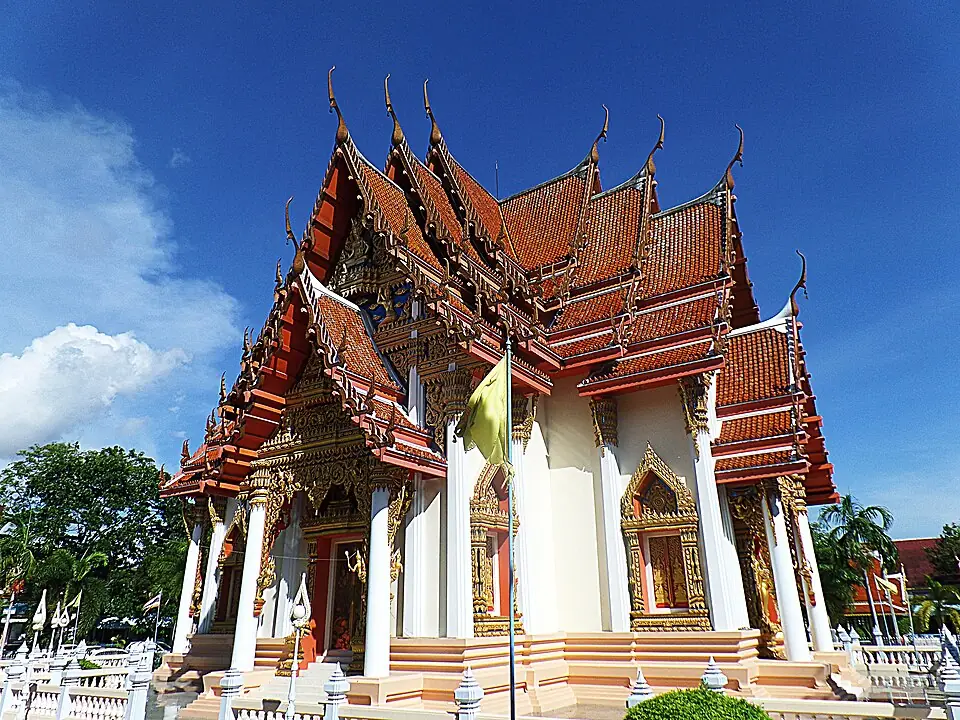
The new ordination hall of Wat Lum Mahachai Chumphon, Rayong · Photo: Panupong Chonswat · CC BY-SA 3.0 via Wikimedia Commons Wat Lum Mahachai Chumphon is in the centre of Rayong. In its grounds are a shrine to King Taksin the Great and a large satue tree to which, it is said, his war elephant was once tethered. The King Taksin the Great Learning Park is next door. The old town around Yomchinda Road is not far away, where you can walk among old wooden houses and visit the Rayong City Museum.
Places to visit nearby
- Wat Lum Mahachai Chumphon and the King Taksin shrine ↗Google Maps
- Yomchinda Road, Rayong old town ↗Google Maps
- Wat Pa Pradu ↗Google MapsThe Tha Pradu area mentioned in the chronicles
- Rayong travel guidesongkran.com
Where to eat nearby
- Cafés and restaurants in old houses on Yomchinda Road ↗Google Maps
- Ban Phe Market ↗Google MapsDried seafood and gifts to take home
- Restaurants around this stop ↗Google Maps
Follow the route yourself
Half a day along the breakout route: Wat Phichai to Ban Phran Nok →
Travel guides for the provinces on this route
Things to do and where to eat in each province, from songkran.com, our sister travel site
- AyutthayaStop 1, 2, 3, 4, 5, 6Ayutthaya travel guide →Food near the ruins →Where to stay →Souvenirs and gifts →
- ChonburiStop 11, 12, 13, 14Chonburi travel guide →
- RayongStop 15Rayong travel guide →
Where historians still disagree
- The dates on this page: converted from the lunar dates in the Royal Chronicle, Phan Chanthanumat (Choem) version, taking Saturday, the 4th day of the waxing moon of the 2nd lunar month, as 3 January 1767. The chronology published by Silpa Wattanatham magazine puts the dates one or two days later, for example arriving at Ban Phran Nok on the 5th and fighting the Burmese from Pak Nam Cho Lo on 14 January.
- The size of the Burmese force at Ban Phran Nok: the royal chronicle says 2,000 foot soldiers, while Prince Damrong Rajanubhab gives about 200.
- Where the fight with the Burmese from Pak Nam Cho Lo took place: the memorial chedi is at Pak Nam Cho Lo in Bang Khla district, but the chronicles say the fighting was beside the road among the reed thickets, after the Burmese had landed at Tha Kham. Sujit Wongthes suggests it was at Tha Kham in Phanom Sarakham district.
- Flight or orders: the Thai chronicles tell it as if Phraya Tak decided for himself. Some foreign sources suggest he may have been ordered out to raise forces.
- The route along the Si Maha Phot forest: the chronicles do not name each night's halt, so the line on the map for this stretch is approximate.
- Local legends along the route: the stories of Nang Pho, Khun Chana, the hunter Nok and the hunter Thong are oral tradition and are not in the royal chronicles.
Frequently asked questions
Which way did Phraya Tak break out?
East from Wat Phichai, by way of the Hantra plain, Ban Khao Mao, Ban Sam Bandit, Ban Pho Sao Han, Ban Phran Nok, Nakhon Nayok, Prachin Buri, Chachoengsao and Chonburi, reaching Rayong at the end of January 1767.
Where did Phraya Tak fight the Burmese on the way?
Four times: on the Hantra plain on the evening he left Wat Phichai, at Ban Pho Sao Han and Ban Phran Nok on 4 January, and for the last time against the Burmese force from Pak Nam Cho Lo on 12 January. The fights at Ban Bang Dong and at Rayong were against fellow Siamese.
What event does Cavalry Day commemorate?
The fight at Ban Phran Nok, Uthai district, on 4 January 1767, when Phraya Tak rode out with four other horsemen and broke a Burmese cavalry force of 30 horses.
How long did the march take?
About three weeks, from the evening of 3 January until the arrival at Rayong at the end of January 1767.
- Royal Chronicle of Thonburi, Phan Chanthanumat (Choem) version – Collected Chronicles, Part 65 – Thai Wikisource (in Thai)
- King Taksin the Great's First Step towards Regaining Independence: From Wat Phichai to Ban Phran Nok – Thammasat Journal of History (in Thai)
- From Ayutthaya to Thonburi: A chronology of key events in the life of King Taksin – Silpa Wattanatham (in Thai)
- Foreign evidence on the last days of Ayutthaya: Phraya Tak broke out "on orders" – Silpa Wattanatham (in Thai)
- Sujit Wongthes: The clash with Phraya Tak at Bang Kong – Matichon (in Thai)
- King Taksin's fight with the Burmese at Tha Kham, Phanom Sarakham district, Chachoengsao – Sujit Wongthes, Matichon Weekly (in Thai)
Last updated 13 November 2026