Home › Campaign routes › The breakout through the Burmese siege: from Wat Phichai to Rayong › Pak Nam Cho Lo
Pak Nam Cho Lo and the edge of the Si Maha Phot forest
Pak Nam Cho Lo is where Khlong Tha Lat flows into the Bang Pakong River, in Bang Khla district, Chachoengsao province. In January 1767 the Burmese had both a land force and a fleet stationed here, and went up in pursuit of Phraya Tak's force, which led to the last fight with the Burmese on this route.
What happened here
The force went into the forest and rested at a pond. At four in the afternoon soldiers from the rearguard came running in, cut at by pursuing Burmese. Nai Bunmi rode back about 200 sen (about 8 km) to look, and found a Burmese force coming up from Pak Nam Cho Lo, by land and by water, which had landed at Tha Kham.
- Against
- The Burmese land force and fleet stationed at Pak Nam Cho Lo
- Where
- Beside the road among the reed thickets, between the edge of the Si Maha Phot forest and Pak Nam Cho Lo. The exact site is still debated: the memorial chedi is at Pak Nam Cho Lo, Bang Khla district, while Sujit Wongthes suggests the fight took place at Tha Kham, Phanom Sarakham district
- How
- Phraya Tak had large and small guns set in ambush on both sides of the road and sent the porters with the provisions on ahead. He then led a hundred-odd soldiers out to lure the Burmese, about 6–7 sen (about 250 metres) in front of the guns. When the pursuing Burmese came within range, the guns fired together. They lured and fired in this way three times.
- Outcome
- The Burmese fell in heaps and broke. The soldiers shouted and beat gongs and drums after them, so that the Burmese could not rally. After this fight the chronicles mention no further Burmese pursuit.
The place today
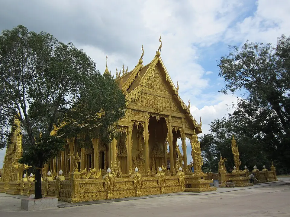
The chronicles say the Burmese came up from Pak Nam Cho Lo, landed at Tha Kham and then fought beside the road among the reed thickets, so the fighting did not take place at the river mouth itself. Some versions of the chronicles write the name of the river mouth as Chao Lo. Sujit Wongthes suggests the site was at Tha Kham in Phanom Sarakham district, and Fine Arts Department evidence has been cited to show that the fighting did not happen where the chedi stands. At the river mouth there is a memorial chedi for the event. Next to it, Wat Pak Nam Cho Lo has an ordination hall that is gold all over, and a statue of King Taksin beside the hall, facing the river.
Position on the map: The pin is at Wat Pak Nam Cho Lo, Bang Khla district; the actual site of the fighting is still debated
Places to visit and eat near Pak Nam Cho Lo
Places to visit nearby
- Wat Pak Nam Cho Lo (the golden ordination hall) ↗Google Maps
- King Taksin the Great Memorial, Pak Nam Cho Lo ↗Google Maps
- Wat Pho Bang Khla ↗Google MapsA temple whose trees are full of roosting flying foxes
Where to eat nearby
- Bang Khla Floating Market ↗Google MapsFood beside the Bang Pakong River; open at weekends, so check before you go
- Restaurants around this stop ↗Google Maps
Last updated 13 November 2026